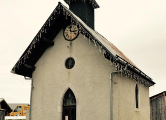
From the ski center to the forest: 20 minutes Cross the village to the chapel which is in the middle of the hamlet. At the chapel, follow the direction “Tour de Romme” to the right for 1 hour. The road goes up and passes by the restaurant "La Rebloche". 200 meters higher, take the road to the right at the intersection, then immediately take the path which departs to the left in the direction of "Tour de la Tête de Romme". The markup is then made of wood with blue paint. Cross the fields following the path. Before the forest, follow the direction to your right "Tour de la Tête de Romme par Charvet".
Bypass of the Tête de Romme by Charvet : 20 minutes The path takes you into the forest and from there the climb becomes easier. The path will then turn left to go around the Tête de Romme and bypass this mountain. Follow the arrows in blue and the paint marks in blue and red on the trees. Enjoy the unobstructed view of the Cluses valley. At the next intersection continue the descent to the right following the indication "Tour de la Tête de Romme" (the trees are marked with the numbers 12-13). You are at a place called Barme Rousse.
Return to the home by Les Sangles :40 minutes The descent then becomes steep for 300 meters to the next intersection. This is the main difficulty of this walk. Then follow the path indicated on the left "Tour de Romme by the Straps" (marking the tree with the number 14). The path is flat and climbs several times. Follow him ; it then becomes narrower and descends. You will have a beautiful view of the village of Le Reposoir before arriving at the top of the village of Romme. At the wooden post marked "Tour de Romme par les Sangles", continue straight across the fields to reach the village.
Ouverture
From 01/04 to 15/11.
Tarifs
Free access. Topo rando on sale at the Tourist Office.
Contact et accès Hameau de Romme 74300 Nancy-sur-Cluses Haute-Savoie (74)