/!\ Warning: exceptional closure of the Col du Palet refuge due to lack of water
Departure : Champagny Le Haut, parking Le Laisonnay d'en bas Arrival : idem Duration : 4h one way. Count 7 hours of walking in total.
Itinerary to the Glière refuge: green level (moderate - from 5 years old). Itinerary to the Col du Palet: red level (difficult). Col du Palet refuge at 10mn : sleeping, meals, drinks - tel : 04 79 07 91 47
Caution, dogs are not allowed!
To be noted: The glaciological trail To enable you to observe the glaciers, the itinerary between the Laisonnay and the Chalet du Grand Plan has been equipped with eight numbered markers along the path. Full explanations are given in a booklet entitled "Discovering the glaciers of Champagny en Vanoise", a real discovery tool, sold at the Tourist Office.
Guidebook with maps/step-by-step
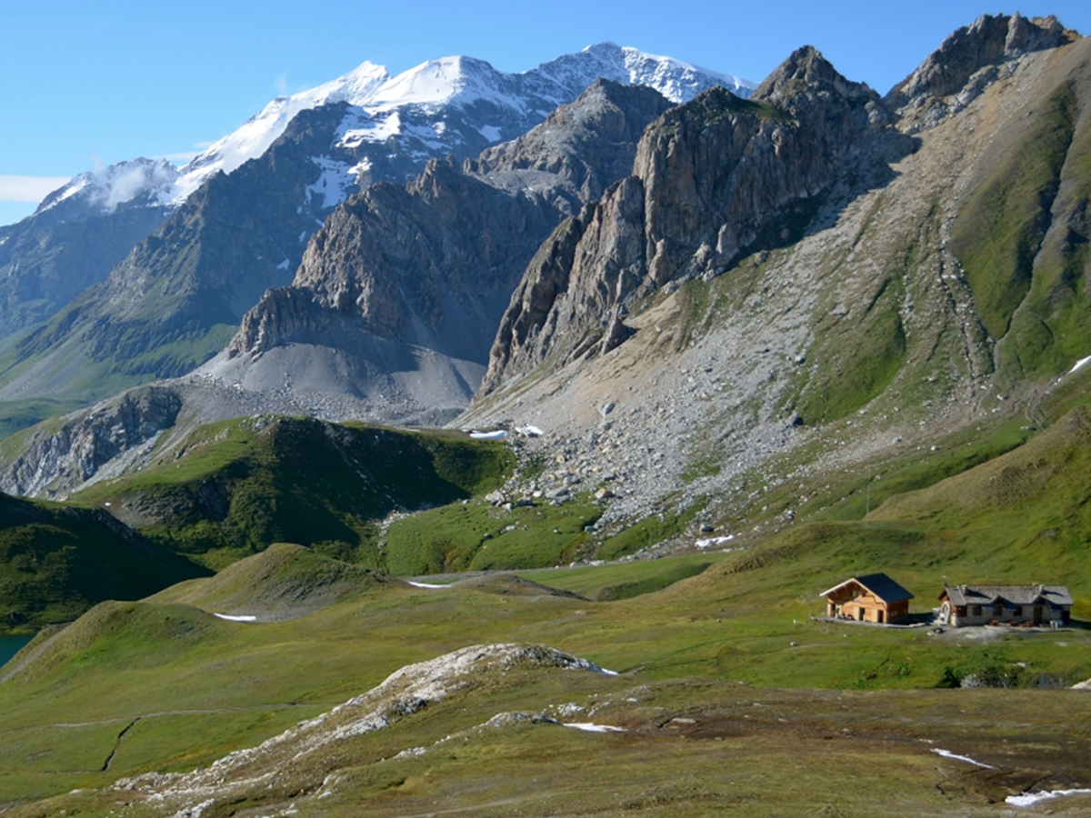
0/ From the Laisonnay car park (1560m), take the tarmac road for 300m; after the bridge, first turn left onto the track which then goes to the right, towards the Glière refuge (1996m). From time to time, a path allows you to cut the track (signs).
1/ From the refuge, retrace your steps to get back on the track that climbs to the chapel and the lake. On the left, a fairly steep path rises up and joins the track above; you quickly reach the Plagne mountain pasture; you pass below the Plan du Sel chalet where Beaufort cheese is made, the "Prince of Gruyères" which has a registered designation of origin.
2/ The itinerary continues on a path that crosses under the Grand Plan chalet; it rises slowly up the Combe du Grand Plan (East) to reach the Col de la Croix des Frêtes, which it reaches (alt. 2647m).
3/ From there, by crossing, we reach the Col du Palet (alt. 2652m) in 15 minutes.
This pass allows you to switch to the GR5, to the resort of Tignes, located 1h20 away.
Return : By the same route.
Tips for the photographer
Many marmots up to the Glière Refuge
Ouverture
From 01/05 to 01/11.
Subject to favorable snow and weather conditions.
Tarifs
Free access.
Contact et accès Parking Le Laisonnay d'en bas Champagny le Haut 73350 Champagny-en-Vanoise Savoie (73)