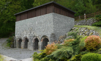
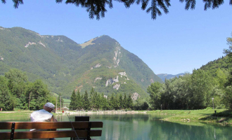
From the Carré des Tisserands carpark, take rue des Fabriques street, turn left on Route du Thovey – be sure to visit the recently restored “Glacière” (ice house) – take the second right onto a dirt road called Chemin de la Grande Biolle, which ascends through the forest and then descends to a hamlet called Les Gras. Continue on the paved road until you reach the church in Cons-Sainte-Colombe, and then take Chemin des Raffours to the “Fours à Chaux” (old lime kilns), well worth the stop. Turn immediately right onto a dirt trail that ascends through a forest clearing towards Ombre Dessus – there are technical sections with roots and stream crossings. Once in Ombre Dessus, continue riding on the paved road, and just after you leave the hamlet turn left onto a dirt path. When you meet up again with the paved road, turn left and then not too far down turn right,through the forest onto a dirt trail that descends to Ombre Dessous, first along a small wall and then a stream – on your left you will see a well-preserved communal oven still in use today – continue your descent until you reach D182 road at Pont d’Ombre bridge. Turn right to take a break at the artificial lake in Marlens and walk the educational trail. Ride back to Pont d’Ombre bridge, then take the first trail on your right, which is located just below a small chapel. The trail meanders through the forest, along “le Biel” stream, and then crosses two clearings before leading to an intersection. Turn right and ride through the prairie to join up with the bike path. Take the bike path to Rue des Grandes Pièces which you will ride on until you reach D182 road. Cross D182 road and take Route du Thovey back to the Carré des Tisserands carpark.
Ouverture
All year round.
Subject to snow conditions.
Tarifs
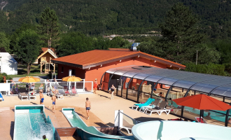
Free access. 5 mountain bike routes kit to purchase for 3€ in the Faverges and Doussard Tourist Offices.
Contact et accès 32 route d'Albertville Carré des Tisserands Faverges 74210 Faverges-Seythenex Haute-Savoie (74)
Balisage : Le parcours est balisé avec des panneaux représentés par un pictogramme triangle orange ainsi que 2 ronds orange indiquant le sens de la direction.