Hiking trail: Lac des Pierres Blanches via Esselet
Les Bauches m
JNJ Photo
Description
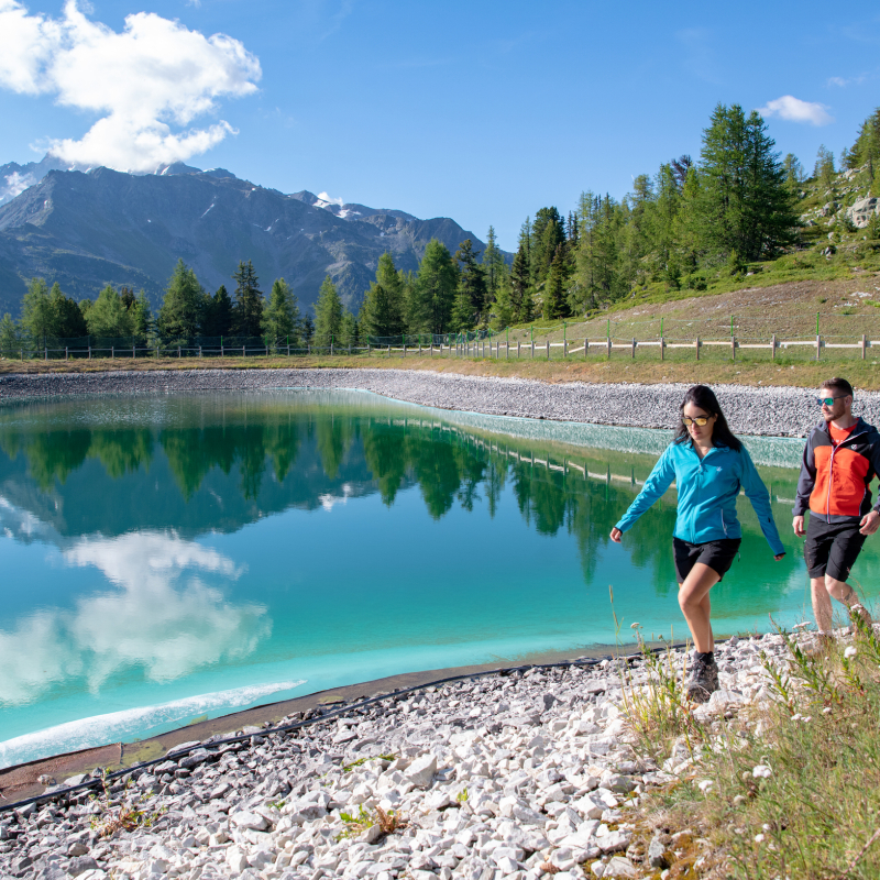
A lovely hike through the larch, spruce and Swiss stone pine forest. The trail follows an old canal to a pond where the forest opens up to offer beautiful views over Peisey valley and Notre Dame des Vernettes chapel in the distance. During the hike, you may hear the sound of cowbells as you walk towards Lac des Pierres Blanches where you can admire the superb views while you enjoy a picnic on the tables by the lake.
Guidebook with maps/step-by-step
Starting from Les Bauches 1/ Drive to Les Bauches on the road that carries on 6km beyond Les Coches. 2/ At Fontaine Froide (junction) keep following signs to Les Bauches. 3/ Park in the parking area opposite the bridge. From there, walk back along the road and follow a small canal to Esselet pond (P). 4/ Turn left up the path (sign to Esselet) through the forest to a small plateau (P). 5/ Cross the plateau and carry on along the path which comes out onto a forest track (P). 6/ Take it to the left and then after 200 m, take the path off to the right (P). The forest gradually becomes a sort of massive garden filled with spruce, larch and Swiss stone pine trees. The path then comes to a plateau that is almost like a clearing (P). 7/ Turn off to the left, walk right across the plateau (about 350 m) 8/ Climb slightly to the right, coming out in a large meadow (P). 9/ Climb up the grassy slope (stony path) to the small road (P) and then on to the chalet that you will see. Go round to the right of the chalet and you will find the Lac des Pierres Blanches.
P = signpost on the route
You can either follow the same route back down, or take the small asphalt road that leads back down to the car park (1 hour).
Ouverture
From 24/06 to 02/09/2023.
Tarifs
Free of charge.
Contact et accès Les Bauches Les Bauches 1770m 73210 Montchavin-les-Coches Savoie (73)