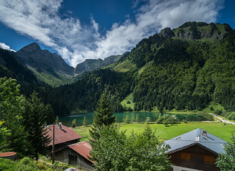
Discovery of the Lac des Plagnes Unesco Geopark site and climb to the Tindérêts refuge
Abondance
Patrick Brault
Description
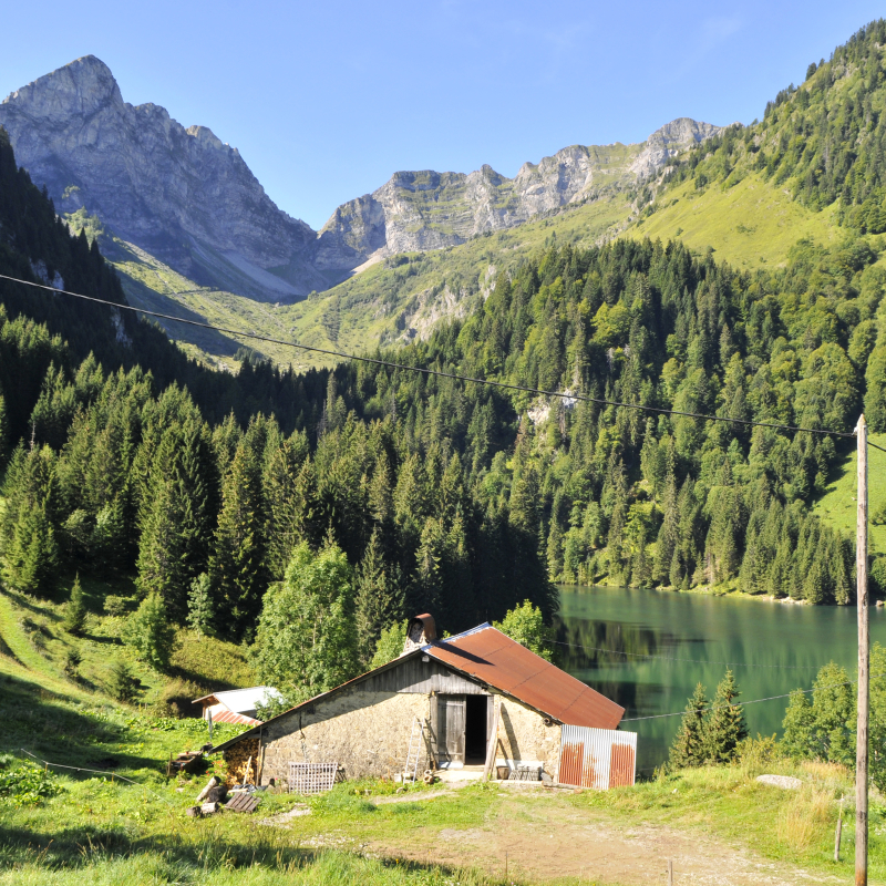
After a walk along the edge of the Lac des Plagnes, head towards Cubourré, you will discover a nice waterfall in the forest and you will reach a peaceful plateau, bathed by a stream and overlooked by the Pointe d'Entre Deux Pertuis and the Pointe de Chavache.
The Lac des Plagnes site, classified as a Unesco Geopark, is a unified geographical area whose sites and landscapes are of international geological interest. All along the route, interpretation panels invite you to understand the geological evolution of this place.
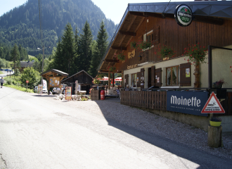
A path leads to the Tindérêts refuge. During the summer school holidays, everyone can enjoy a gourmet break in the refuge after the climb.
Tips
Refuge des Tindérêts is open in summer with a small restaurant on the spot at lunchtime. Half-board and accommodation on site. In winter, the refuge is open on reservation. Snowshoe and fondue evenings. Reception for individuals and groups.
Guidebook with maps/step-by-step
0/ Car park at Lac des Plagnes 1/ Go down to the edge of the lake on the dam. 2/ Take the direction "Chemin du tour du lac" passing by the right side of the lake. 3/ A little before the bridge at the end of the lake, take the path that goes up in the forest towards "Cubourré". Follow the path along the wterfall. 4/ At the top of the path, turn right towards "Refuge des Tindérêts" and continue on the path, which is flat at the start and then climbs higher and higher. 5/ At the intersection, take the path on the left towards "Refuge des Tindérêts". 6/ A path will lead you to the refuge. 7/ The return is by the same path. You can reach the car park by following the road down towards "Lac des Plagnes".
Tips for the photographer
At the departure, view of the Lac des Plagnes and observation of the local fauna and flora. Discovery path of the flora on the way.
Ouverture
From 01/06 to 01/11.
Subject to favorable snow and weather conditions.
Tarifs
Free of charge.
Contact et accès Parking du lac des Plagnes 74360 Abondance Haute-Savoie (74)